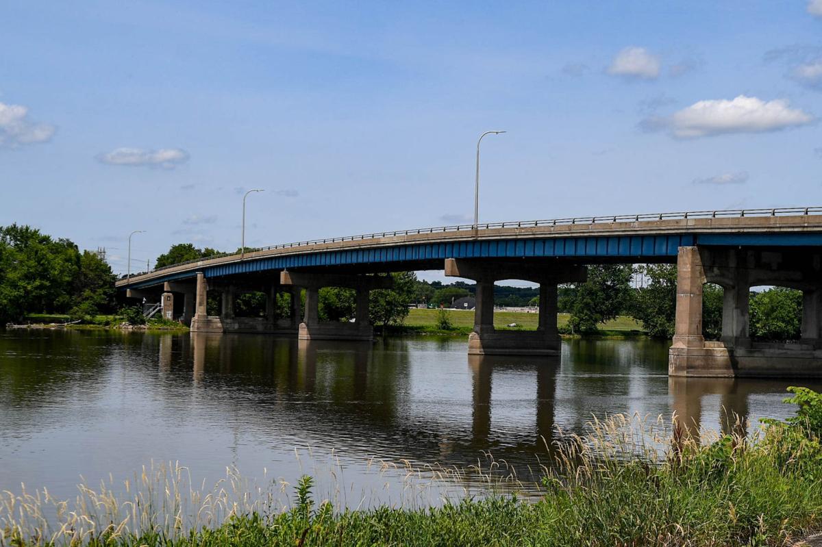
Leaders along the Rock River in Illinois Quad-Cities are concerned about an update to the flood maps that would expand flood areas 1 of 3 Leaders of nine governments in the Illinois Quad-Cities are concerned about a proposed Rock River flood map that would expand land under strict flood regulations. The officials say the expansion
Leaders along the Rock River in Illinois Quad-Cities are concerned about an update to the flood maps that would expand flood areas
Leaders of nine governments in the Illinois Quad-Cities penned concerns to the state of Illinois about a proposed Rock River flood map decades in the making that would expand land under strict flood regulations. The officials say the expansion would hamper economic growth and burden property owners.
The maps, which Illinois started surveying for in 2009, would update the area to meet the state’s flood mapping regulations. The updated maps expand the floodway, a regulatory area reserved for flood water discharge that has more rigid regulations on development to avoid increased flooding upstream.
The mayors of Colona, East Moline, Moline, Silvis, Rock Island, Milan, the presidents of Carbon Cliff, Coal Valley, and Hillsdale, and the chairs of the Rock Island County and Henry County boards signed onto the letter, dated June 23, to the Illinois Department of Natural Resources.
Engineers develop a floodway map by using a hydraulic model to simulate water flow and add encroaching artificial development such as dikes and buildings into the 100-year floodplain, which squeezes the simulated river until the water surface level from a 100-year flood rises 0.1 feet. That’s where engineers stop adding development, and map the borders of a floodway. Once a map is approved, developers looking to build in a floodway must prove that any new building or obstruction would not raise the water surface level during a 100-year flood. The flood water rise is one of three targets engineers must account for when making the maps — there are thresholds that can’t be crossed for flood water storage and water velocity change, too.
That 0.1-foot threshold in Illinois is stricter than FEMA’s one-foot threshold, which was one complaint leaders of Illinois cities had about the flood regulations. The bordering state of Iowa adheres to FEMA’s one-foot requirement.
In Illinois, that means neighborhoods in Colona, Coal Valley, and Moline would be reclassified as a floodway, as well as land at Interstate 80 and 88 in East Moline that was considered for a 10,000-job development. In the letter, Illinois Quad-City government leaders wrote that the more stringent requirement “ultimately places Illinois border communities at a competitive disadvantage with bordering states, specifically Iowa.”
”Businesses will simply not spend the time and money to even look at the possibilities for compensatory flood storage, due to the additional cost of engineering studies, the lengthy and potentially challenging reviews by state permitting agencies, and the potential cost of flood insurance,” the letter stated.
In an email to the Quad-City Times, Director of the Office of Water Resources Loren Wobig said Illinois Department of Natural Resources was preparing a response and would provide a comment after the letter went through the proper channels to be reviewed, signed, and sent to the mayors.
In an interview in mid-June, before the letter from the mayors was sent, Glenn Heistand, a senior hydraulic engineer at the Illinois State Water Survey said when the current maps were initially created, decades ago, they didn’t reflect the state’s standards.
The new proposed maps are a decade in the making. New maps were surveyed for in 2009 by the Illinois State Water Survey and the U.S. Army Corp of Engineers, and the first engineering analyses were shown to community officials in 2011. The maps faced similar questions and concerns from community leaders, and the model underwent several revisions. In 2014 the Office of Water Resources provided a concurrence letter for the hydrology.
Then, the project was shelved until fiscal year 2017.
At that time, developments were modeled for 37 streams, which updated 152 miles and added 40 miles to the study. According to an Illinois State Water Survey fact sheet, as a result of the new information, “model results changed very little.” In 2020, the OWR again offered concurrence with the hydrology behind the model.
City officials expressed concern with increased flood insurance costs for new structures in the floodway which could cause property owners to be less likely to sell their homes, “which may cause neglect, vacancies, or foreclosures.”
Moline, Colona, and Coal Valley, have neighborhoods that would be reclassified in the floodway. Permits currently managed by localities would then be required to get permits from the Office of Water Resources, which city leaders wrote “doesn’t have the time or staff now to process permits they receive in a timely manner.”
The hydraulic modeling takes into account more severe flooding than has ever been measured at the Rock River. A 100-year flood, which means it has a 1% chance of happening every year, hasn’t been measured yet on the Rock River, surveyors say.
“While on average 3 out of 4 centuries may experience a 100-year flood, there is a 1 in 4 chance of not seeing a 100-year flood in 100 years of record,” the fact sheet from the ISWS says.
According to the updated analysis, the Rock River flood of record at Como is a 1.5% annual chance or a 66-year flood, which happened in 1916 at 19.6 feet according to the U.S. Army Corp of Engineers. The 19.24-foot record set in 2002 at Joslin is between a 10% and 4% annual chance flood or a 10-25 year flood.
“Much larger floods can be expected,” the Illinois fact sheet stated.
In the letter from city officials, they expressed concern that some non-accredited levees were not taken into account in affecting the flow of the river.
“There are many instances where real-world features including highway embankments, farm levees, raised areas of land, roads, and railroads would restrict or otherwise impact Rock River floodwater flow,” the letter stated that are not included in the updated flood mapping.
When creating flood maps, FEMA mandates that makeshift levees or embankments not accredited by FEMA can’t be included to show they prevent flooding.
“That’s because when levees are constructed, and they physically will block water, of course, which is their purpose, but then if a flood map were to be changed to show that there’s no longer flooding behind this levee where it used to flood, then inevitably, development will happen,” Heistand said. Houses, stores, whatever kind of development, the land use will not be encumbered by the floodplain regulations that used to encumber those locations. And so, it invites development. And then that development implies that they’re safe when they’re only as safe as the levee is strong.”
Sen. Neil Anderson, a Republican representing the river-side of the Illinois Quad Cities, said in an interview that the Republican caucus was hoping to pursue a change to Illinois flooding regulations to relax them to FEMA standards, but if the maps are approved, he said he hoped to see some kind of compensation for residents and business owners it affects.
“I think we have to be very careful on both sides and obviously we don’t want to put people in harm’s way or a business,” he said. “But at the same time, maps are in places that haven’t even flooded in 100 years. So, we have to balance that with the economics of a state like Iowa, right across the river.”
Get local news delivered to your inbox!


Leave a Comment
Your email address will not be published. Required fields are marked with *